Download
Choose your platform


Features
Covers all leisure activities
Walk the Thames path
Find fishing locations
Check camping sites
Find moorings and marinas
Plan your river journey
Find riverside pubs
Lots of detail to help you enjoy the river
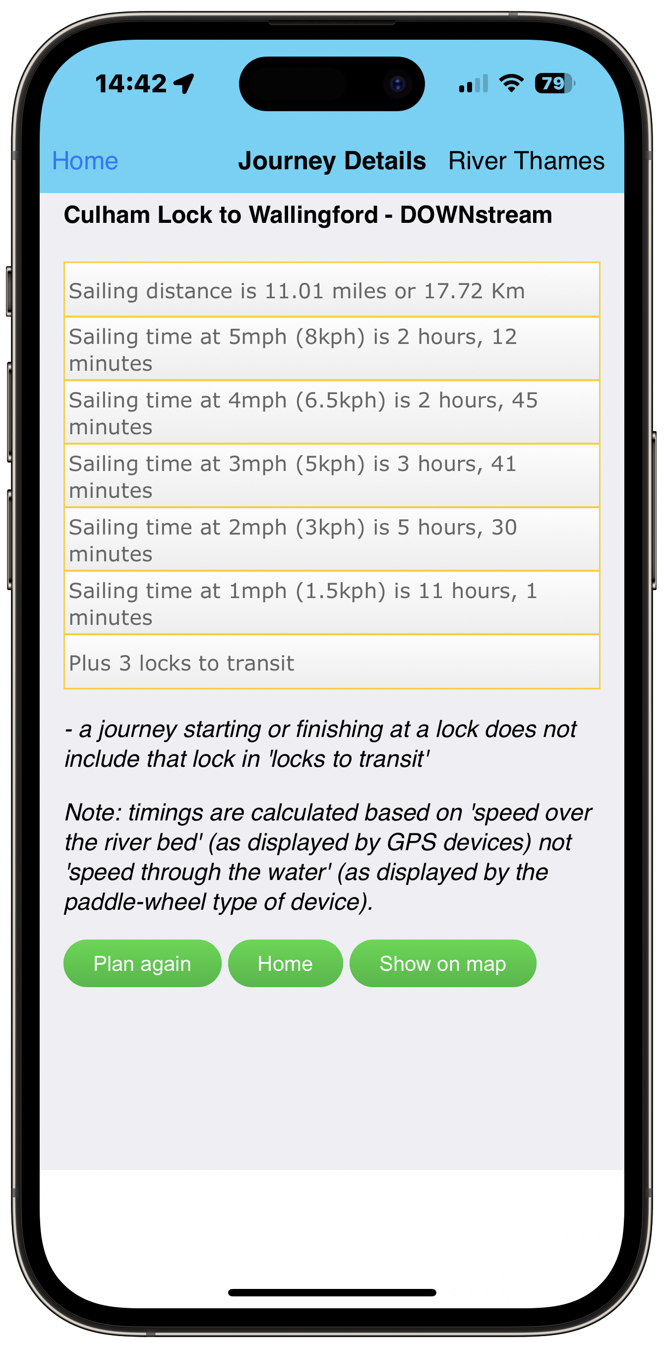
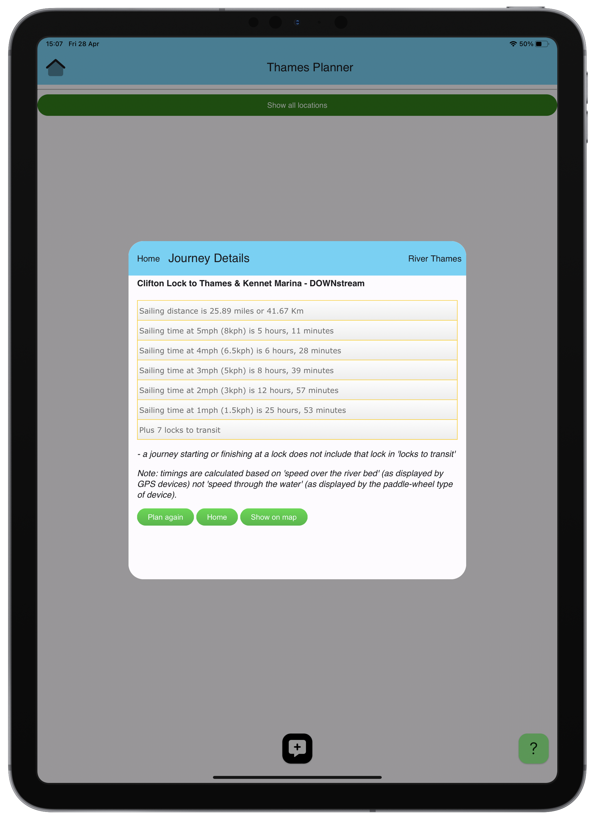
Not sure how long a trip will take?.
Choose your starting and ending locations
For the River Thames there are over 100 locations and more than 40 for the Wey Navigation (including locks, marinas, pubs, and more).
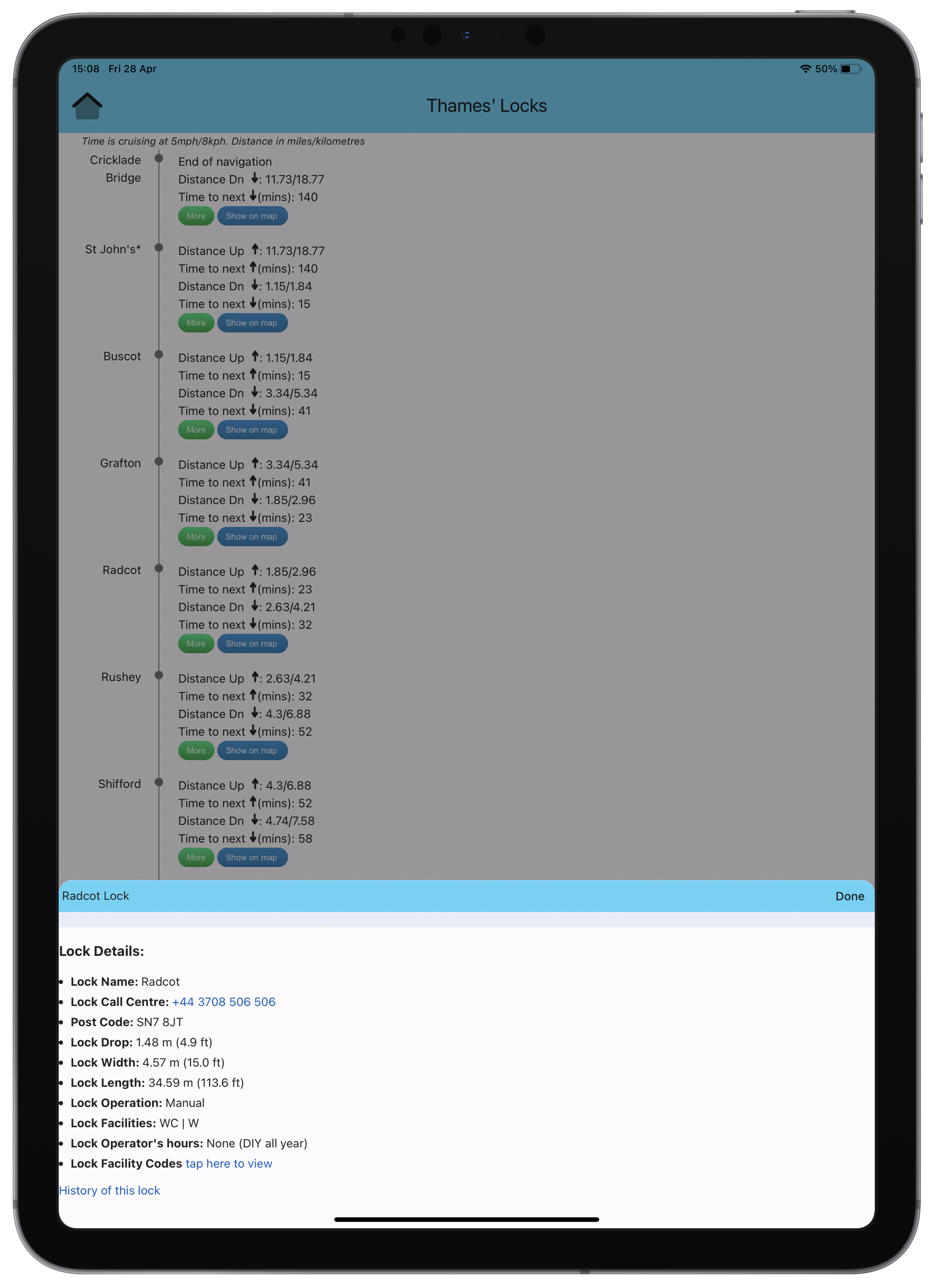
Sailing distance and locks to transit
The app will tell you how many locks on your journey and the sailing time at 5, 4, 3, 2, and 1 MPH.
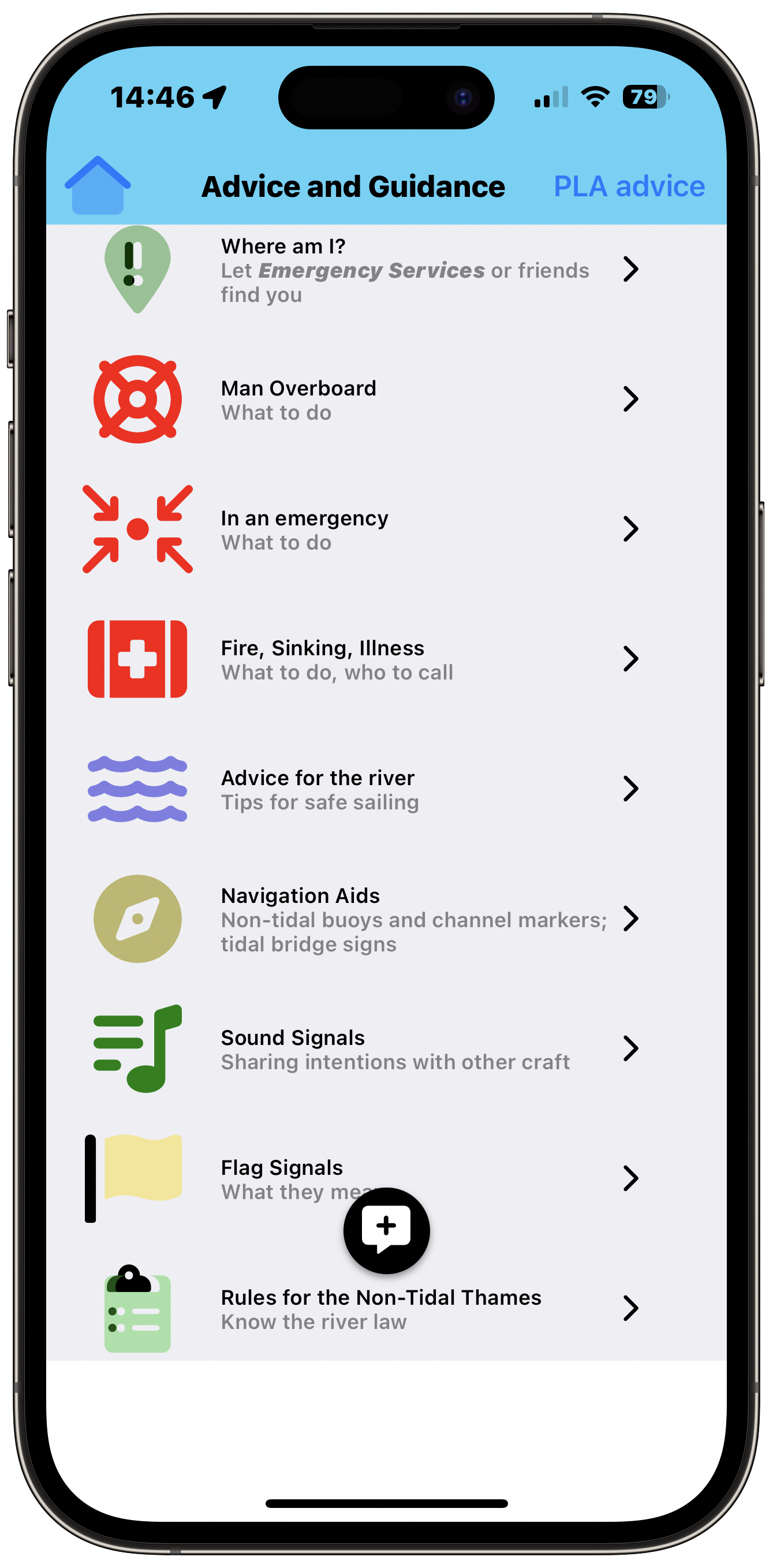
The safety of your passengers, crew and boat is of the utmost importance.
Preparing to sail
All the things you need to know and check and how to make sure it is safe to sail.
In case of an incident
The app will guide you to the nearest Emergency Rendezvous Point.
Just as there are 'Rules of the Road' so there are 'Rules of the River'.
Sound Signals
Indicate your intensions (such as coming about or passing another craft with the correct sound signal.
Correct Navigation
Ensure your journey is safe by following the rules for passing other craft and negotiating marked hazards.

The app supports more than boating activities

Walking
You can overlay the route of the Thames Path on the interactive map.
Canoeing
As well as using the Journey Planner, you can view Portage maps for those locks so equipped.
Camping
Overlay camp sites on the interactive map; click a tent for facilities and contact details.
Fishing
Add designated fishing locations as an overlay on the interactive map.
Paddle Boarding
The Journey Planner includes timing at one mph (typical boarding speed).
Caravaning
Many of the camp sites shown on the map also provide facilities for caravans.
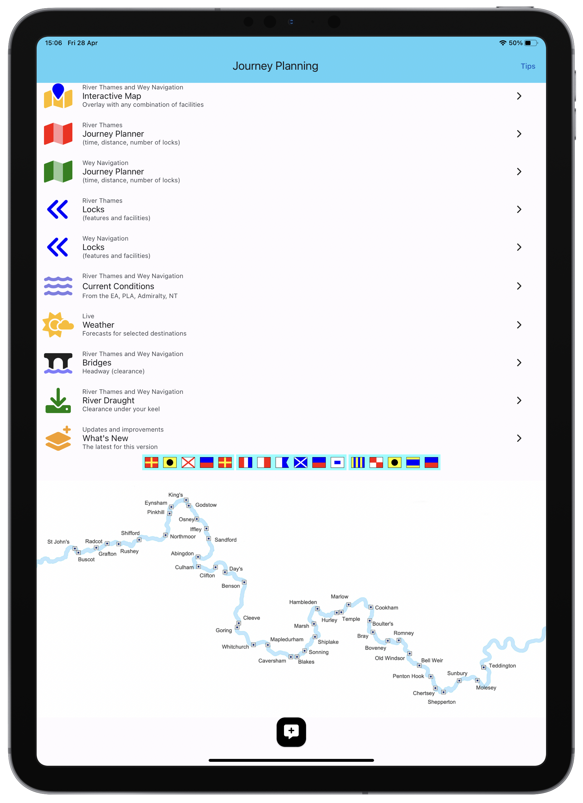
Features
The complete guide to leisure activities on the Thames and Wey
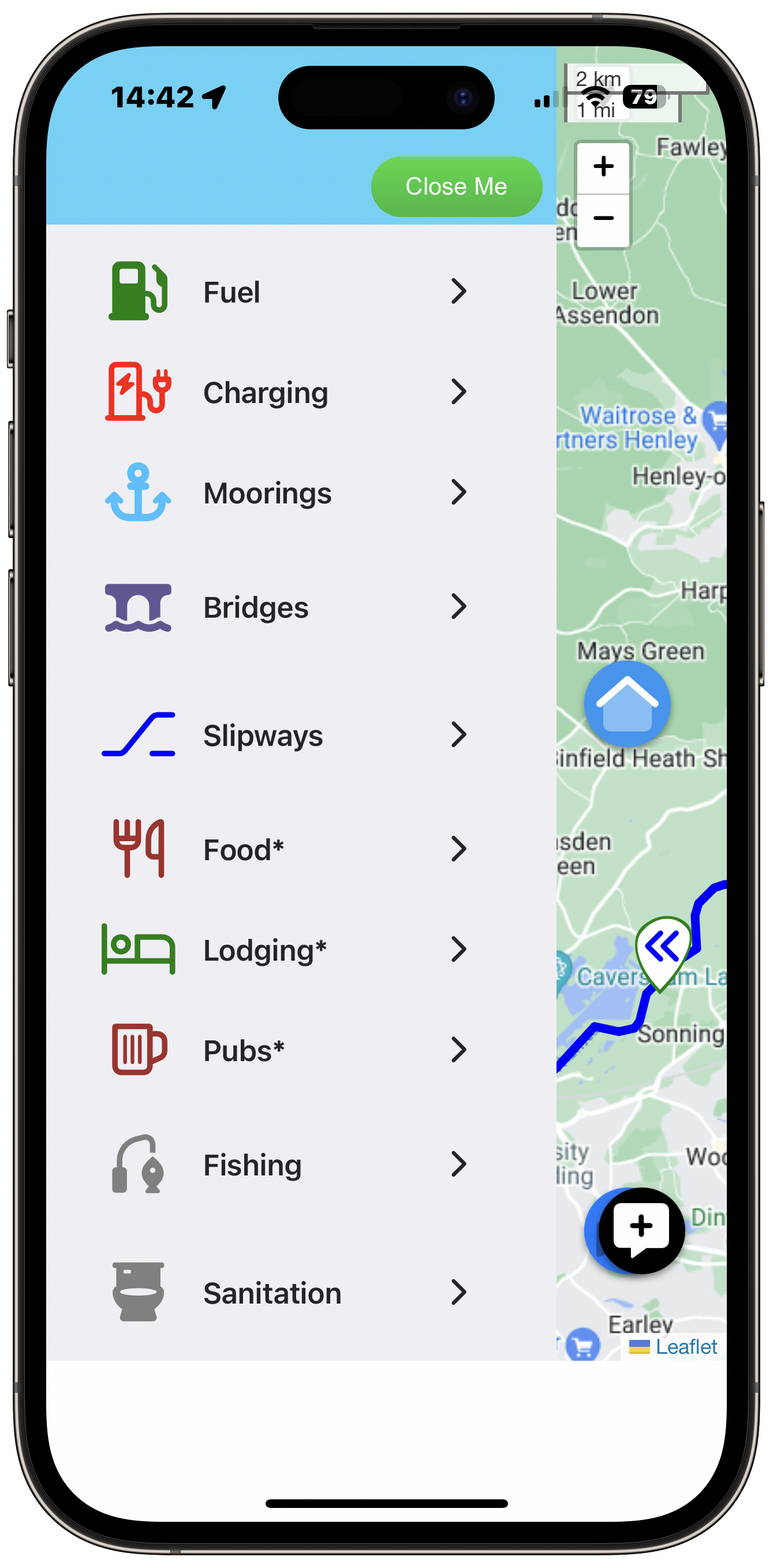
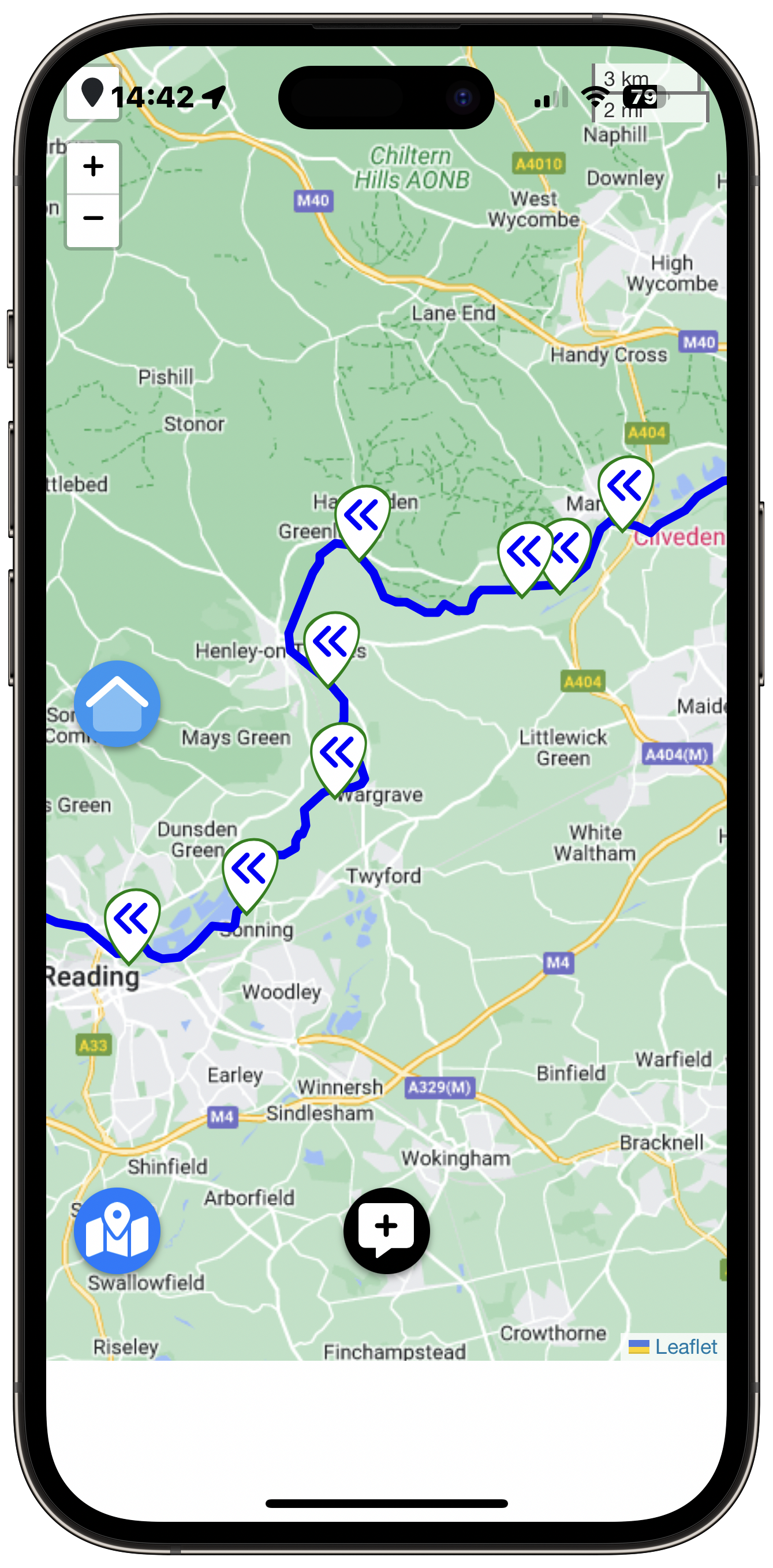
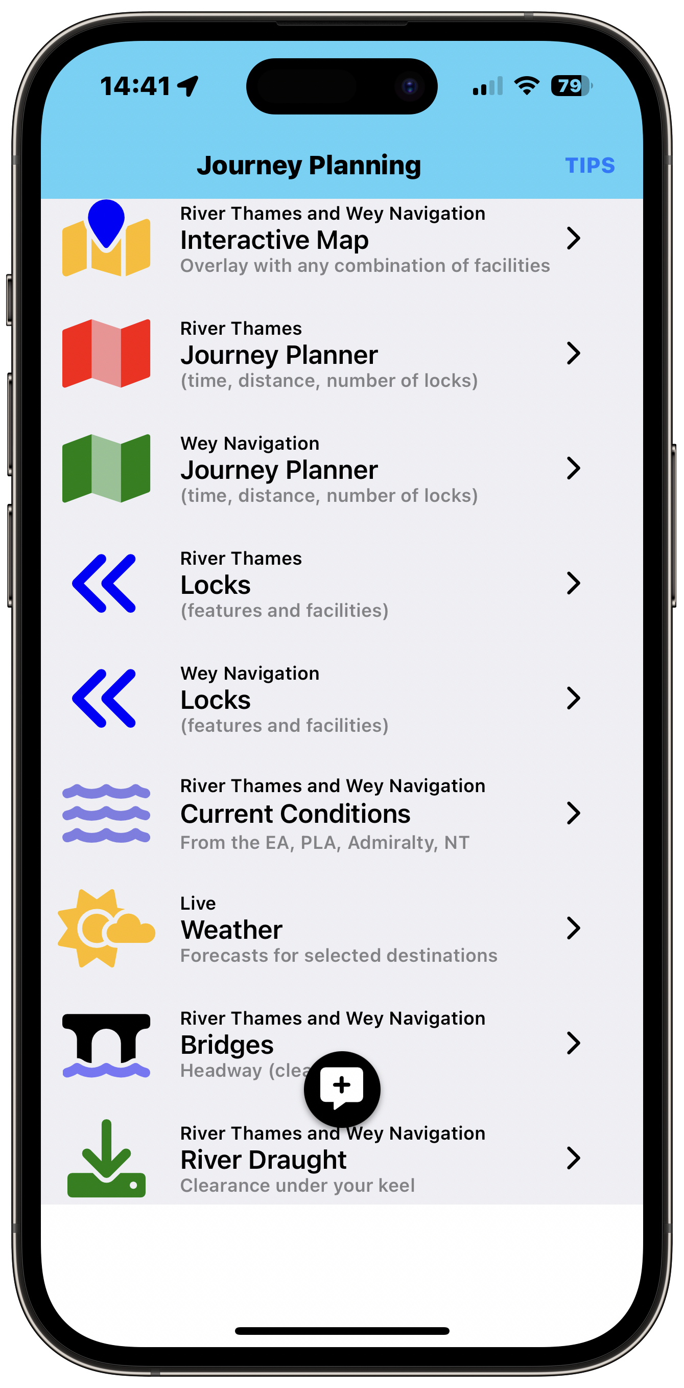
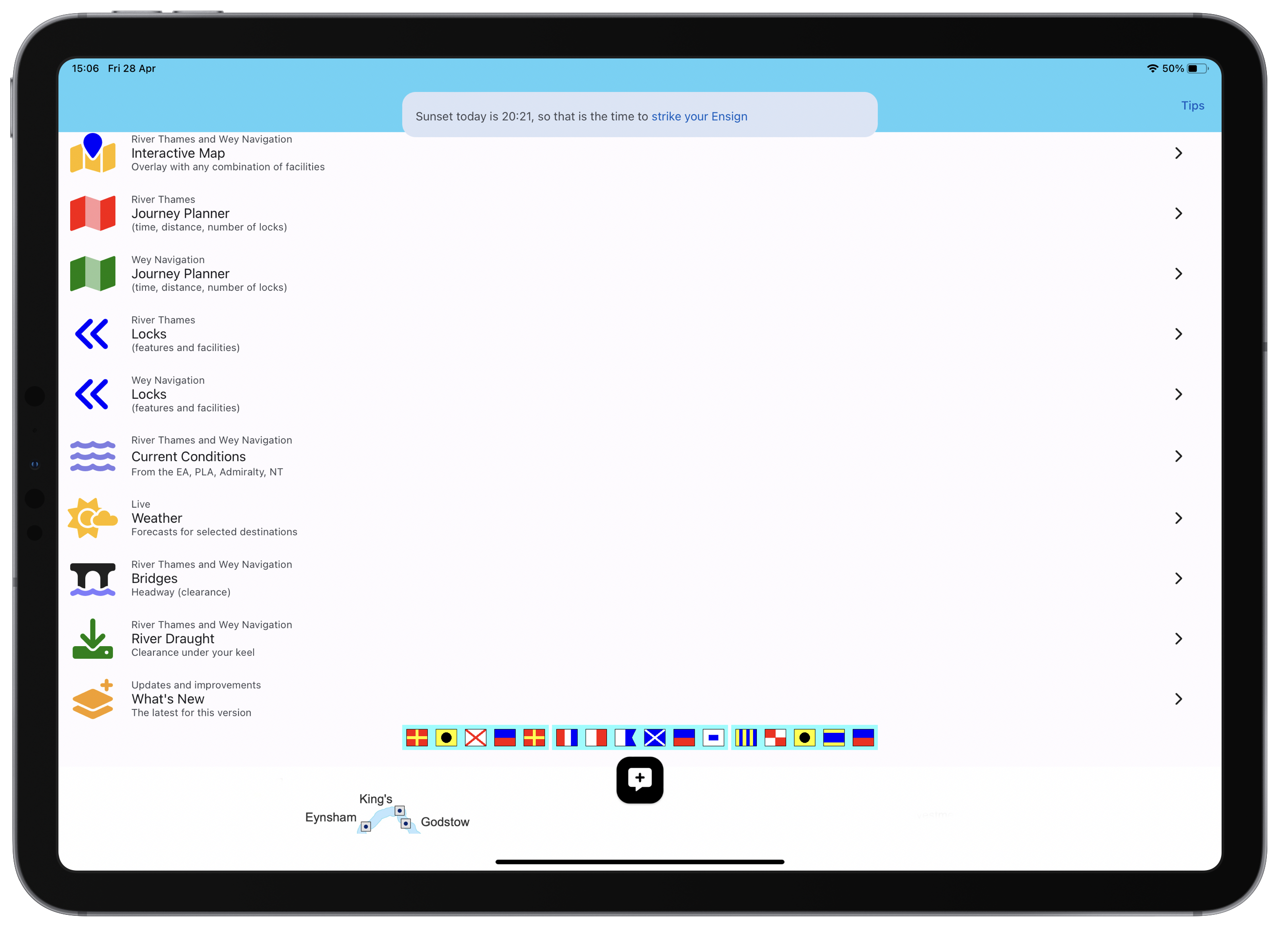
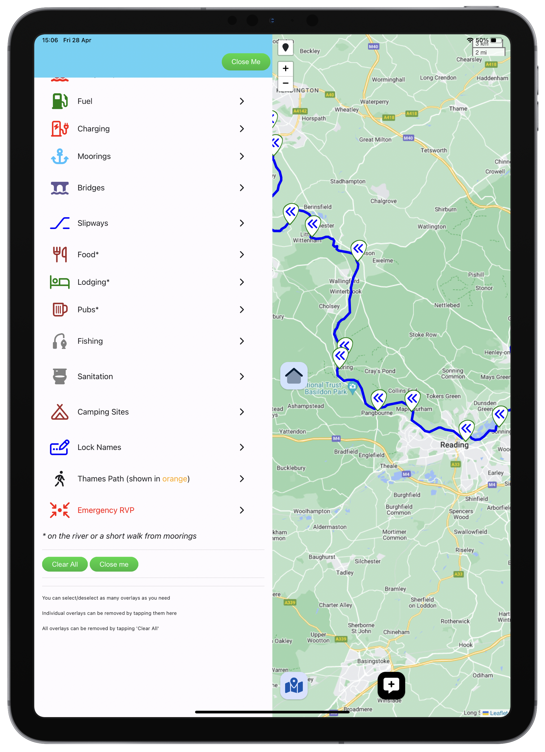
Interactive Map
Overlay a map of the river with any combination of locks, moorings, marinas, bridges, sanitation, fishing, camping, fuel, pubs, Thames path, Emergency RV points.
Journey Planner
Choose from 100+ locations (for Thames; 40+ on Wey) and find the sailing distance, sailing time (at 5, 4, 3, 2 , 1 mph) and number of locks to transit.
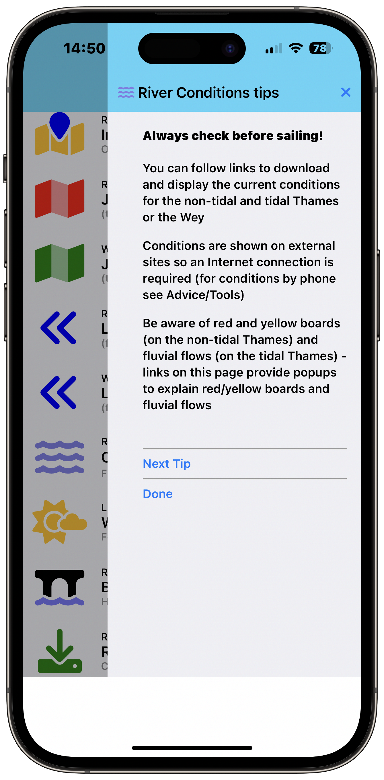
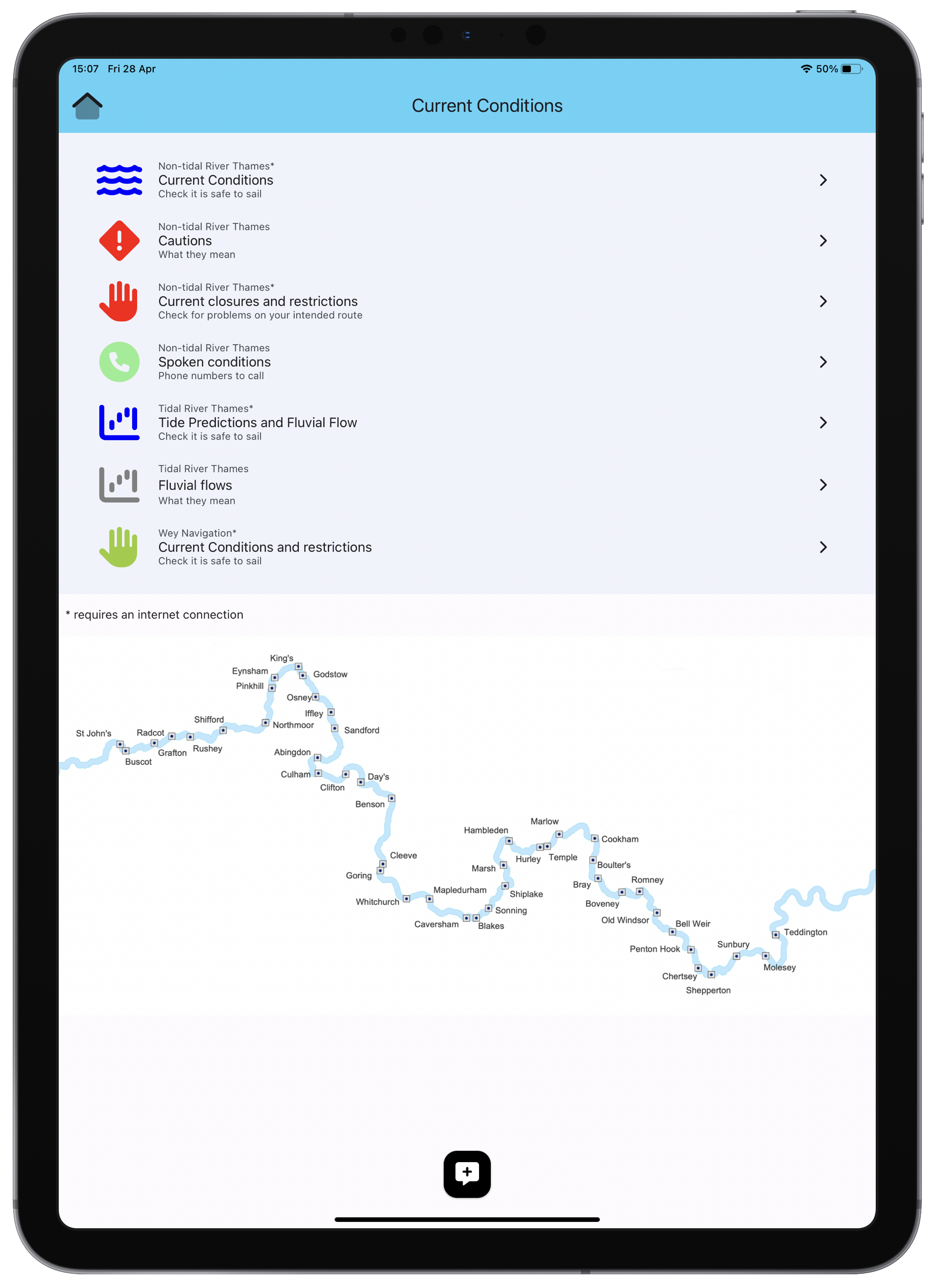
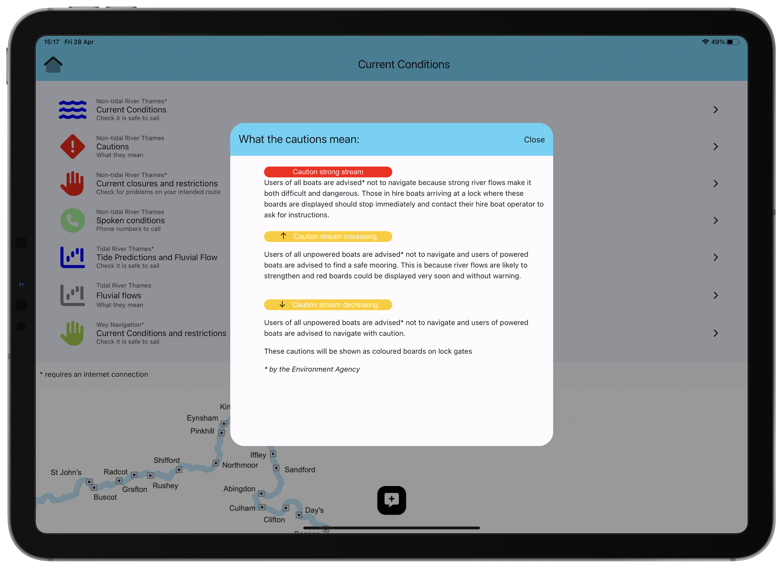
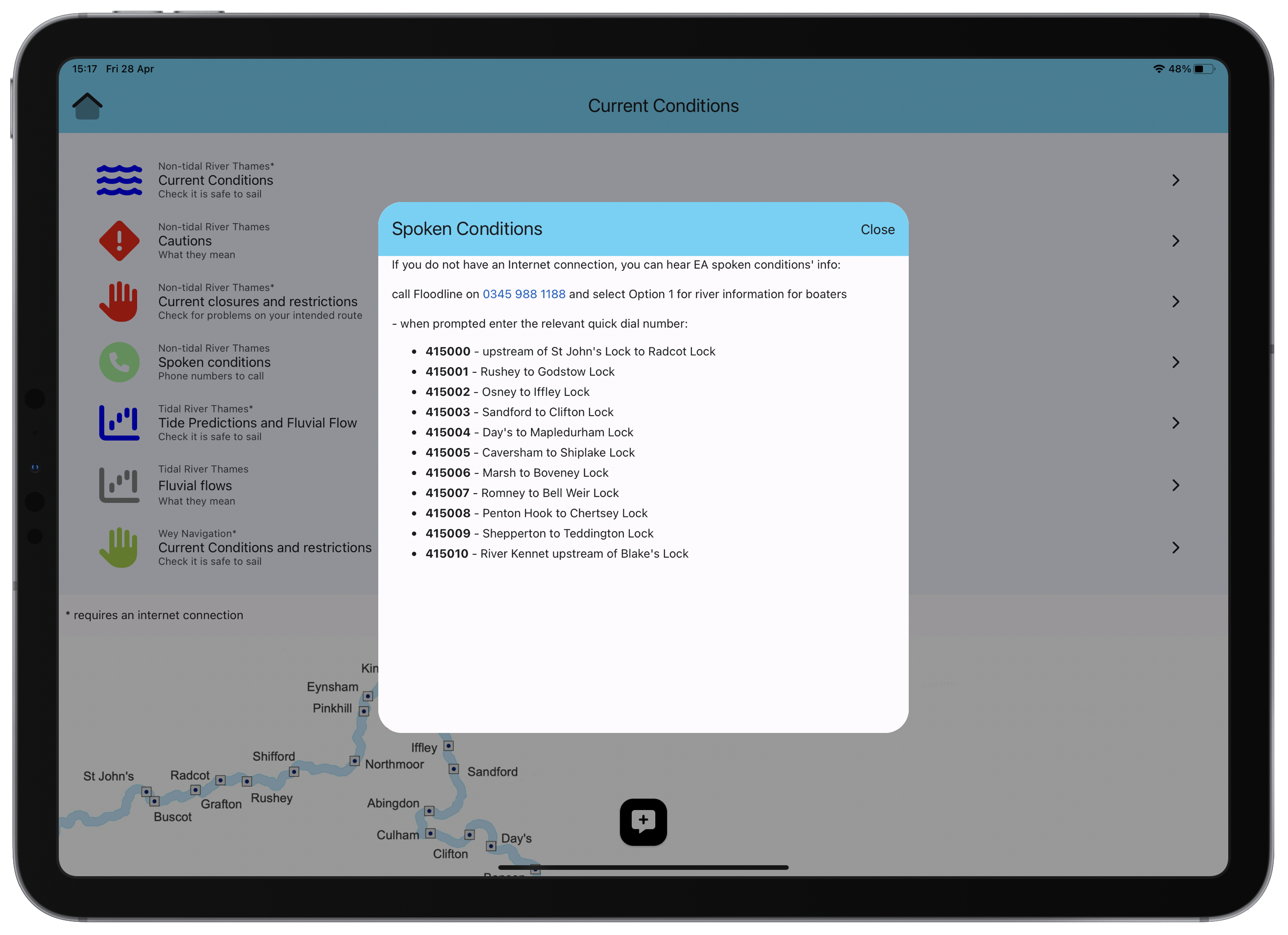
Current Conditions
Link to EA site for current conditions on non-tidal Thames; better still, install the Non-Tidal Thames Shortcut (includes option to see map overlayed with live conditions).
River Weather
See the current and short term forecast for selected locations on the River Thames.
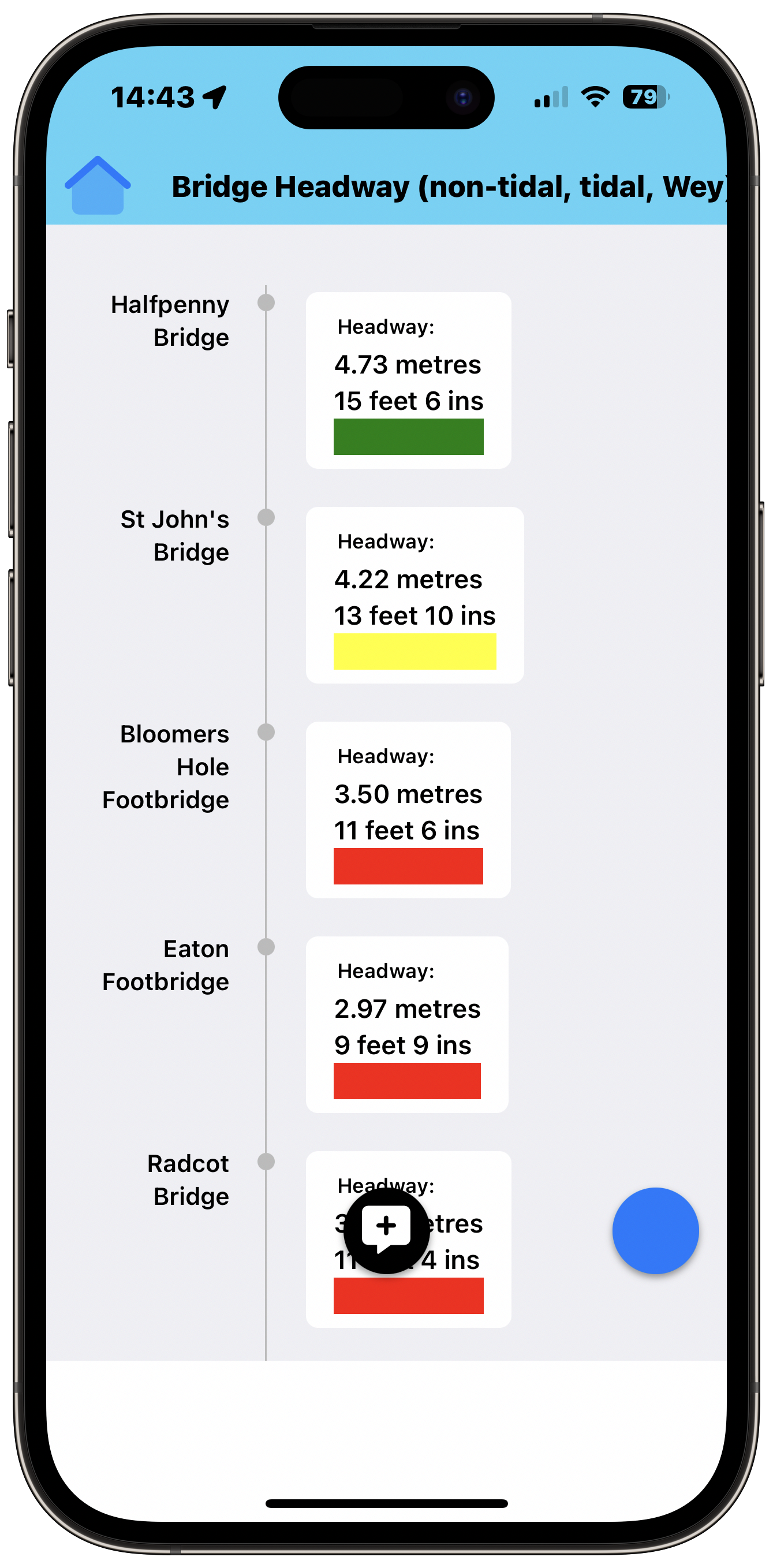
Clearances
Check the clearance (expected gap between water and underside of bridge) for any of the bridges; find the expected water depth for any section.
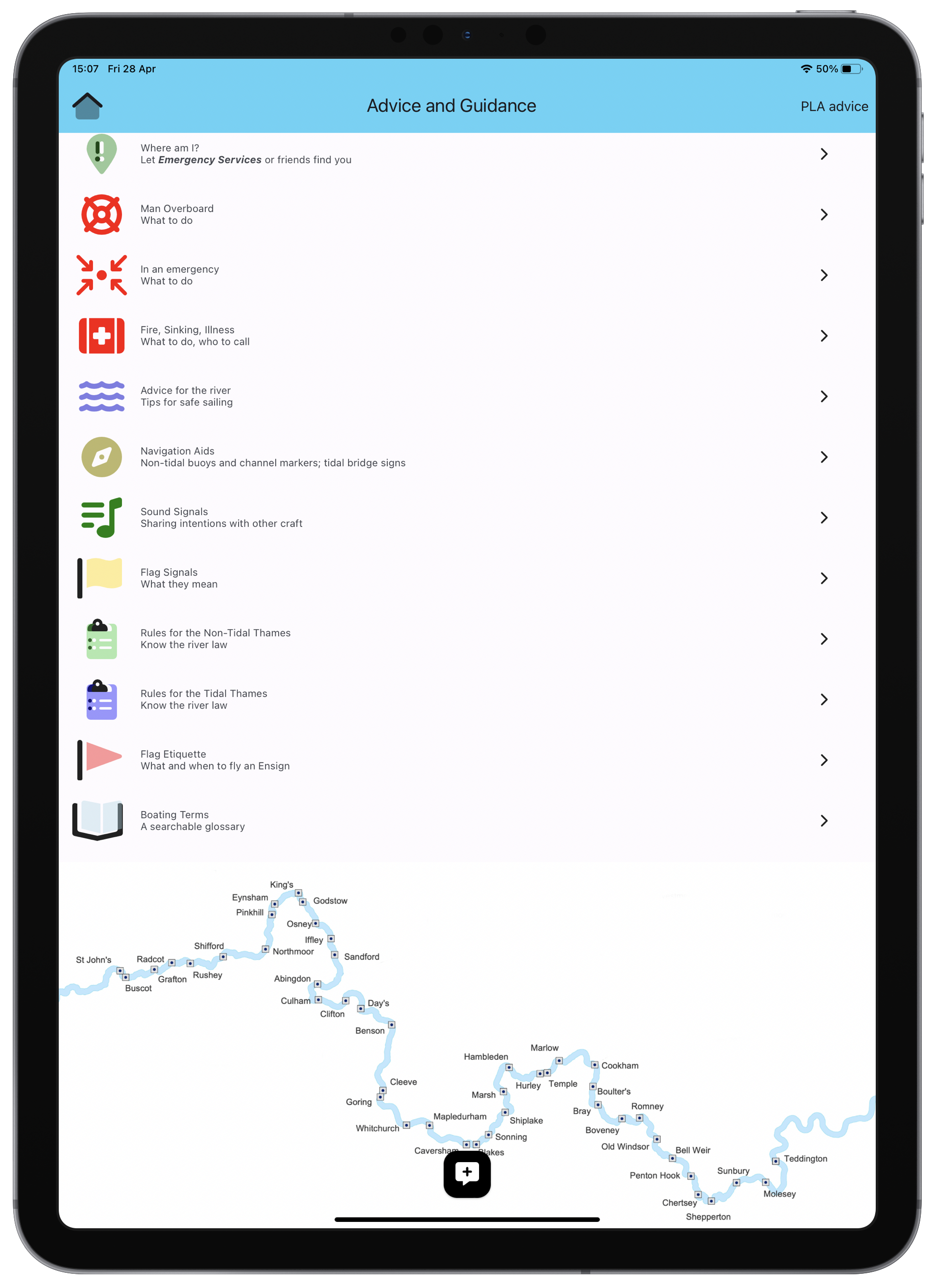
Advice and Guidance
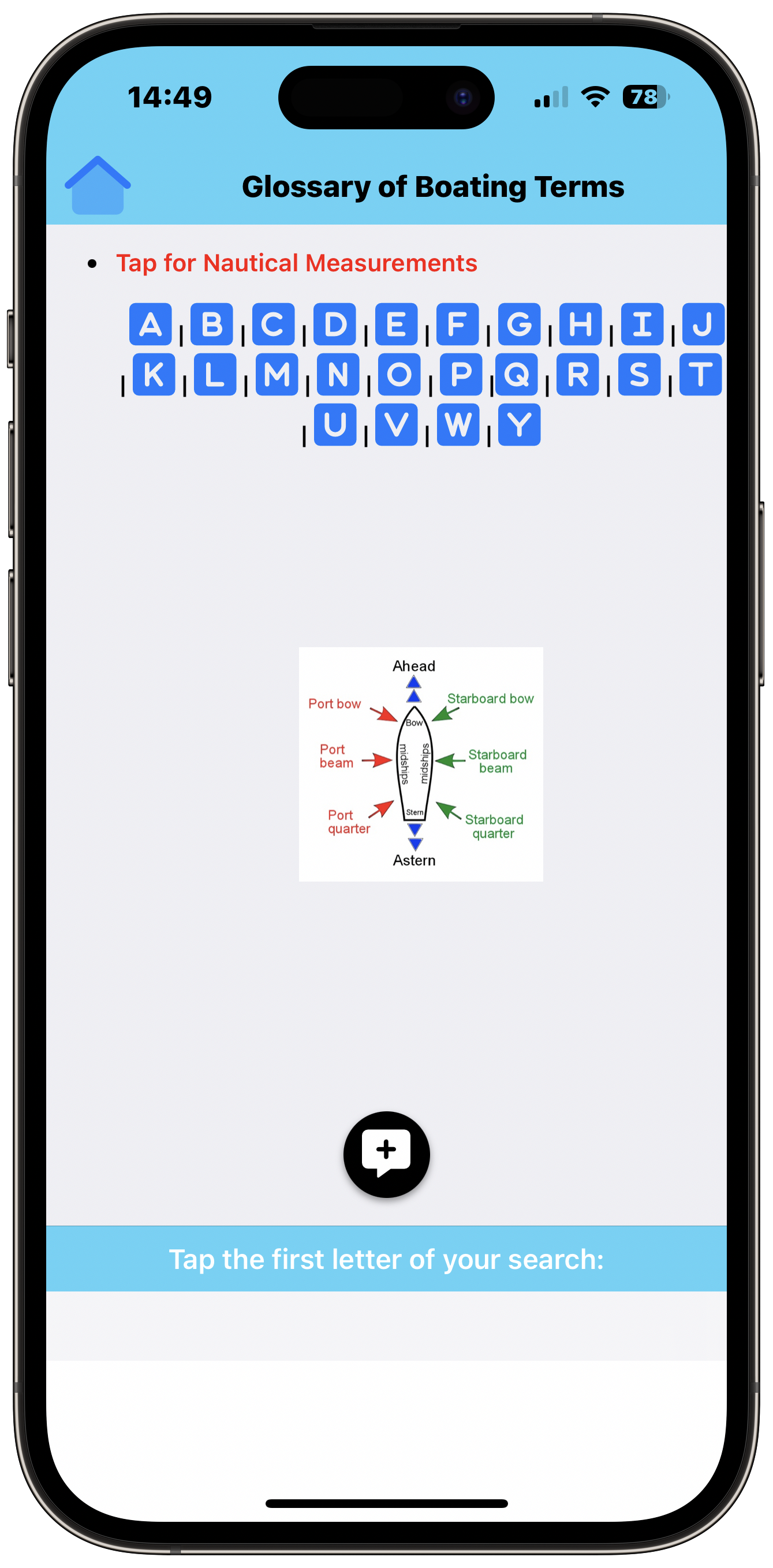
Read the official guidance for safe boating; check the safety steps prior to sailing; read what to do in an emergency; check nautical terms in the Glossary.
F.A.Q
Frequently Asked Questions
Screenshots
iPhone Screenshots
Testimonials
What users say about the app
Conditions
The Conditions Shortcut
More info and download
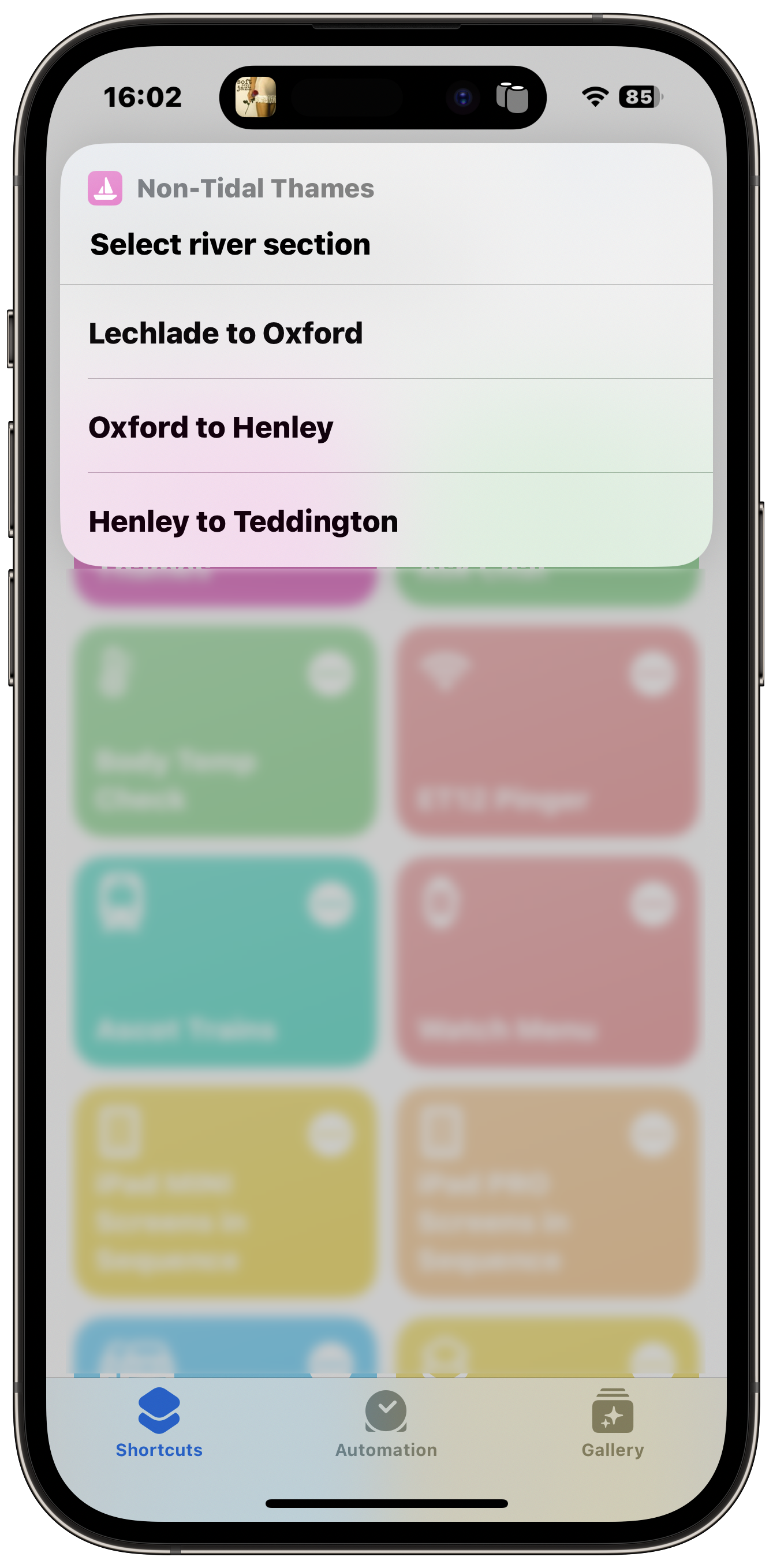
Select the river section
Choose the river section containing the stretch you are interested in.
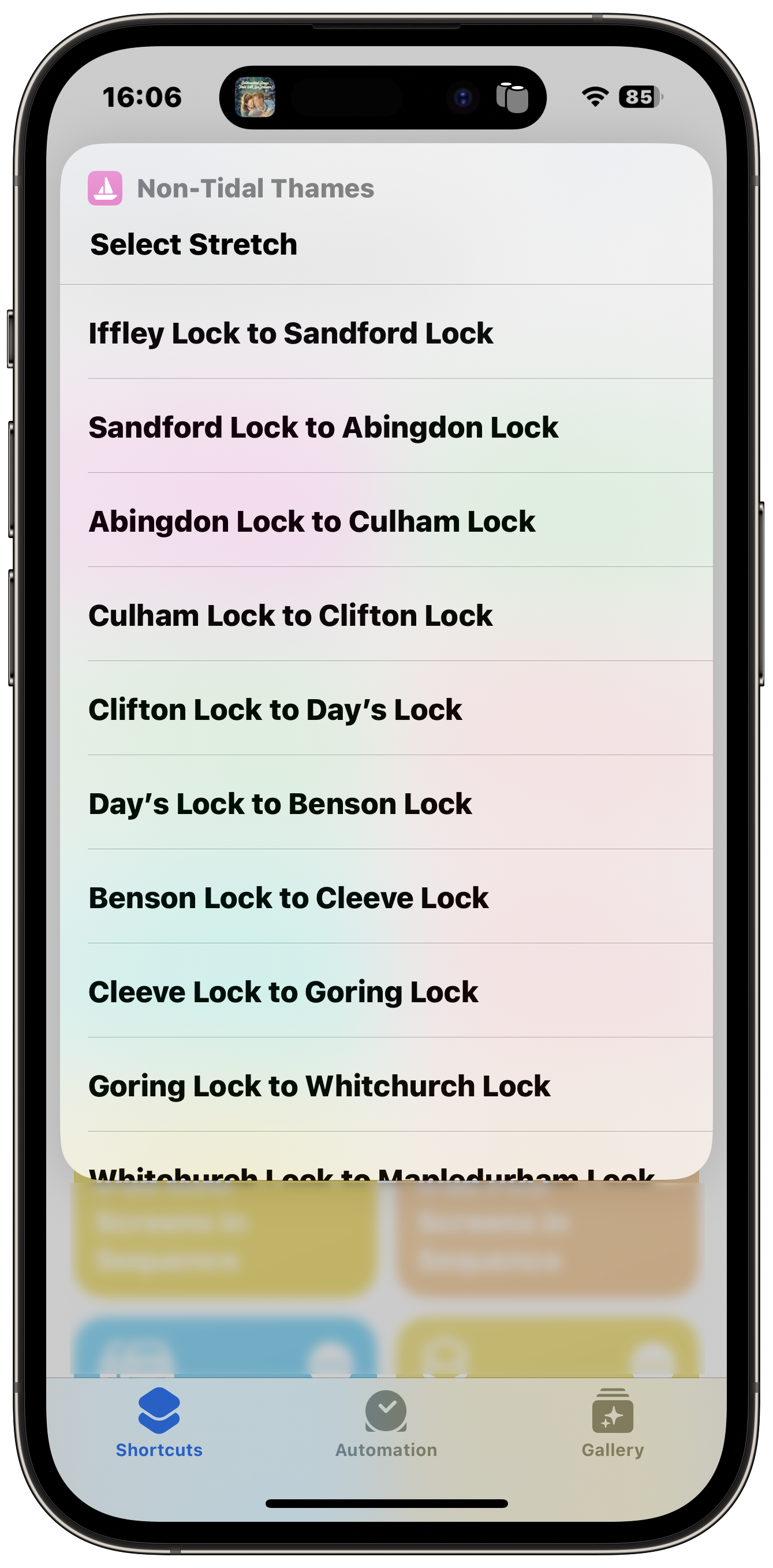
Select the stretch
Tap the stretch for which you want the current conditions to be displayed.
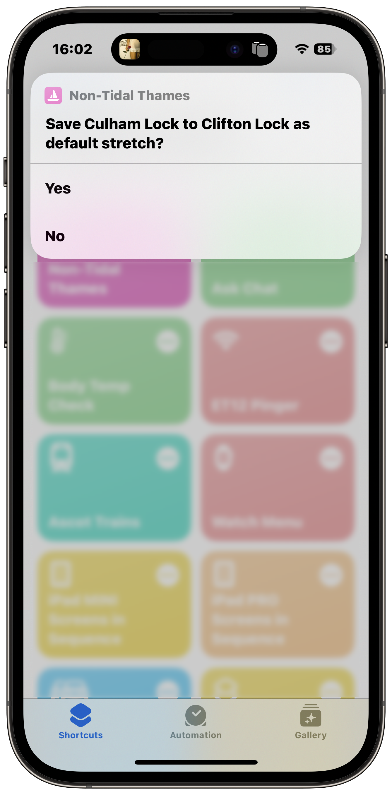
Set as default
Tap 'Yes' if you want this stretch to be the default when the Shortcut is opened.
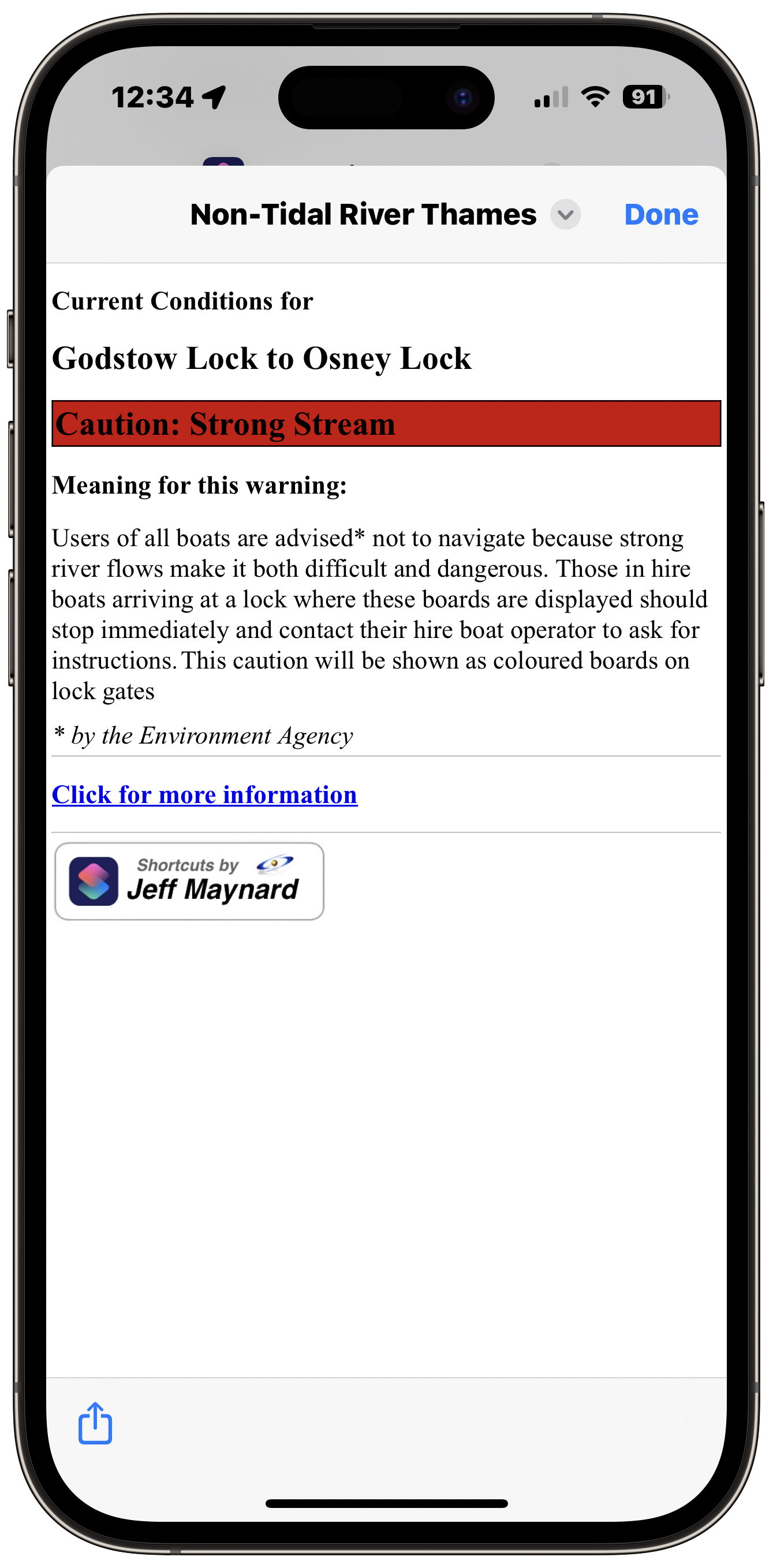
Live Conditions display
The current conditions for the selected stretch are displayed.